Yesterday morning was crisp and clear here in the desert. We had high winds the previous day and evening and I was eager to get out and do my morning hike. Clouds hung on our nearby mountains and it was COLD! I nearly ran to the car to get a jacket, but decided against it. Instead, with the sun just peeking over the mountains, I ventured out for my walk, determined to see what kind of things I would see. I saw several quail feeding at the feeders and heard one off in the distance. A cactus wren flew by with something in its mouth and disappeared into its nest. Ahhhh...morning! Weekend Reflections for May 1, 2010.
Friday, April 30, 2010
Thursday, April 29, 2010
Mountain wildflowers~Out & About~Nature Notes 042910
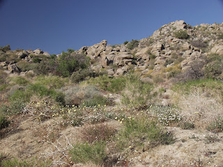
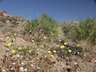
I was out & about this weekend and stopped to admire the various shrubs and plants in bloom in our local mountains. Some of these were just off the highway (Highway 74) which runs from Palm Desert up to Anza and then on through Temecula, as Highway 79. This road goes from 200 feet elevation, in Palm Desert, to over 4,000 feet, at the top of the mountains, and the flora changes dramatically. From desert shrubs and trees to Ponderosa pines at the top of the mountains, I always enjoy viewing them on my travels through our local mountains. Nature Notes for April 29, 2010.
Wednesday, April 28, 2010
"O" is for...ABC Wednesday 942810
Tuesday, April 27, 2010
Pinyon wildflowers~That's My World 042610
While our desert wildflowers are fading quickly in the 90 degree weather we've been having lately, the mountain wildflowers are in full bloom. I stopped near Pinyon on Sunday and took a look around and found these. I like to stop and explore along the road and marvel at Nature's little surprises, like these little flowers! That's My World for Tuesday, April 26, 2010.
Sunday, April 25, 2010
Sunrise yesterday~Scenic Sunday 042510
I woke up at 4:30 yesterday morning and after I had my coffee, I went out exploring. Yesterday and today have been clear, so our desert hasn't had the beautiful effects of the sunrise on clouds, but I did see these hills and the shadow of another one slowly disappearing as the sun rose in the sky. Scenic Sunday for April 25, 2010.
Saturday, April 24, 2010
New snow and dramatic skies!
A storm front moved in this past week, on Wednesday and Thursday, and our local mountains got snow down to 3,500 feet. My horses are boarded at 4,000 feet and the ranch owner sent me an email that they indeed had snow! So, I probably won't be able to work with my horses this weekend, but I'll go up and take photos and feed them their psyllium. I stopped by the road Thursday morning and took these photos. Just LOOK at all that snow! Our mountains have had snow as late as Memorial Day some years. I remember one time, back in the 1970's, when I was still going to graduate school, that my husband and I decided to take the mountain roads home from Riverside to Palm Desert. So, up the mountains we drove (school was just ending, so this was late May...) and it started snowing in Idyllwild. So, yes, we do get late snows and I have a feeling that this year, we may get some!
Friday, April 23, 2010
Lighting~Desert Morning 042310
Thursday, April 22, 2010
Happy Earth Day!
Wednesday, April 21, 2010
"N"is for nest...ABC Wednesday 042110
It is Spring here in the desert and as I took my walk yesterday morning, I noticed two new nests in the cholla along my walking route. They have popped up in the last week! I know because I always walk along the same trail and these haven't been there before. Look how tight the top and bottom ones are. NOBODY is going to mess with those nests! NOPE! ABC Wednesday for April 21, 2010.
Tuesday, April 20, 2010
Keyes Point~That's My world 042010
Keyes Point is an overlook at Joshua Tree National Park. It's elevation is over 5,000 feet and it offers a magnificent view of the Coachella Valley. That is Mt. San Jacinto, looming over the valley, with snow on it. And, as we were taking these photos, a flock of seagulls from the Salton Sea flew overhead. It was interesting to watch them twist and turn in the wind. Some people had no idea what they were and I stopped to explain them to some tourists. The Salton Sea, which is also visible from Keyes Point, is at the southern end of our valley and is home to migratory birds as well as seagulls and pelicans. If you click on the pics (except the top one), you can see the flock. The bottom pic shows Berdo Canyon, which is only accessible by 4 wheel drive or by horseback. That's My World for Tuesday, April 20, 2010.
Monday, April 19, 2010
Cholla garden, Joshua Tree National Park~Cactus Monday 041910
Sunday, April 18, 2010
Scenic Sunday~Barker Dam~~041810
Barker Dam is inside Joshua Tree National Park and is a short hike, about a 1.1 mile loop. It is also a well-marked trail and an easy hike. The only part I had trouble with was where a huge rock overhung the trail right on the pond. However, as I was determined to get to the other side of the trail and complete the loop, a grabbed the rock with one hand and swung over! From that side, I could actually see the dam and the stream below. And, as I continued on the loop, I saw signs pointing to the Indian petroglyphs. Scenic Sunday for April 18, 2010.
Saturday, April 17, 2010
Barker dam~Weekend Reflections 041710
I didn't know about Barker Dam at Joshua Tree National Park until I saw a photo of it on the national park brochure. Of course, then I wanted to see it! When we arrived on Sunday, the parking lot was relatively deserted. That was quite a contrast to Thursday's chaos! There weren't enough spots for all the cars that day because a school bus had pulled in sideways and the bus driver was telling people to move their cars away from the bus in case she had to leave. It is a 1.1 mile loop to the dam and back past the petroglyphs, but it is an easy walk (there are a few steps) and it is well marked. The only place that isn't easy is when you hike past the lake to where the dam actually is. You have to walk right down a step that is partly covered by a huge rock and I didn't do it my first visit on Thursday. By Sunday, when I took this photo, I was determined to get past that spot and I did (and I have a bad back and leg issues). When past that rock, you can actually see the dam and then you walk about .5 miles on the well-marked trail to the petroglyphs, then back to the parking lot. Weekend Reflections for April 17, 2010.
Friday, April 16, 2010
Clouds at Joshua Tree National Park~SkyWatch Friday and Looking at the Sky on Friday 041610
Thursday, April 15, 2010
Yucca blossoms~Thursday Challenge 041510
We visited Joshua Tree National Park over the weekend and found these yuccas blooming along the road. Just LOOK at all the blossoms on them! They must be heavy. I don't know. I looked down and saw all the spikes on a yucca without blossoms and decided to keep my distance! OUCH! Thursday Challenge for April 15, 2010.
Tuesday, April 13, 2010
Joshua Tree National Park~That's My World and Outdoor Wednesday 041310
Hubby and I and our daughter and son-in-law all piled into my Honda CRV early Sunday morning for another visit to Joshua Tree National Park. Hubby and I had visited the park on Thursday, a beautiful, clear day here in the desert southwest. We entered through the Cottonwood Springs entrance and actually arrived before the visitor center opened, so we took some photos around that area before paying our entrance fee. Cottonwood Springs is on the eastern side of the park and like it's name implies, has many cottonwood trees among the palms. Both trees are there because of the San Andreas Fault, which runs along the valley. The cracks in the earth's surface allow the groundwater to come to the surface, thus cottonwoods and palms abound here. There is a long, sandy wash that you can walk along and view the cottonwoods. There are a lot of birds here and we could hear and see them. Hubby went off and followed a noisy crow who apparently did not enjoy our presence! Then we headed up through a smoke tree wash and took pics of the yellow wildflowers along the road. Next, we passed through the cholla garden and the ocotillo wash. We stopped at Jumbo Rocks and went exploring in four different directions. Next, out to Keyes Point for a view of the valley below. Jennifer and James (our daughter and son-in-law) spotted their housing development down in the valley. I could see the Thousand Palms road and the Indio Hills. The Salton Sea lies to the east of the park and although it was a bit hazy, we could also see it. We would LOVE to visit the park on a clear day after a rain and may try to do that this summer. Finally, we hiked up the short trail to Barker Dam. By that time, the kids were tired (not us "old folks") and wanted to get lunch, so we left the park. I would love to return late some afternoon and catch a nice sunset there! We will be returning to the park whenever we can. James mentioned that during August one year, while he was there, it hailed! The elevation at the park varies from about 2,000 feet to Keyes Point, which is over 5,000 feet. That's My World for Tuesday, April 13, 2010.
Monday, April 12, 2010
Cactus! Cactus Monday 041210
Saturday, April 10, 2010
Pushawalla Canyon and San Andreas Fault~Scenic Sunday for 041110
Yesterday afternoon, after spending the morning with my horses and brushing, brushing, brushing them (it's SPRING!), I met my cousin Valerie at her house. She had promised to show me where to park and hike into Pushawalla Canyon, in the Indio Hills. She took one of her horses with her and rode in, while I hiked back about a mile into the canyon. She had told me about the sheer cliffs there (she was riding on top of them, while I was below, in the canyon) and I remembered reading that the San Andreas Fault went right through them, so I stopped along my way and took these pictures. Don't look at the palm trees! Look at the cliffs and how they slant upward at a diagonal. That is typical fault geology. Those cliffs should be parallel to the ground, NOT at a 45 degree angle! That's from the fault. Also, the palms in the canyon are also from the fault. Faults make cracks in the earth's surface, from which water in the underground aquafer rises to the top. I noticed that on my hike back out of the canyon, there were several springs. Water just came to the top of the surface, flowed a way, and then dried up. It was interesting to see all the little springs in the canyon. Hmmmm...probably not a good place to be when the big one hits, eh? I enjoyed my hike through the canyon and will post more about it in future posts. Be sure to look at these pics of the cliffs and see how they jut upward!
Friday, April 9, 2010
Ocotillo and blue sky~Looking at the Sky on Friday 040910
Hubby and I drove through Joshua Tree National Park yesterday. It was a beautiful, clear day here in the desert. I woke up at 5 a.m. and we were on the road by 7:00. We drove through the southern entrance, by Cottonwood Springs. Hubby wanted to catch the early morning light in that area, which is actually closer to us than the western entrance near Joshua Tree. Along the way, we drove through the ocotillo patch. Many of the ocotillos were already blooming, including this one. Looking at the Sky on Friday for April 9, 2010.
Subscribe to:
Posts (Atom)